 |
 |
 |
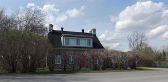
|
 |
Caption:Maison Atelier du peintreAlfred Pellan.
© 2014 nicole leduc
Title: Maison Atelier du peintreAlfred Pellan.
|
|
 |
 |
 |

|
 |
Caption:maison-atelier
© 2014 nicole leduc
Description: Maison atelier du peintre quebecois
Alfred Pelland.
A auteuil-bld des milles-isles....Laval.qc.canada
|
|
 |
 |
 |

|
 |
Caption:Sanctuaire Marie-reine 5199 sherbrooke est .montrealpc.canada.H1T3x2
© 2014 nicole leduc
Title: Sanctuaire Marie-reine 5199 sherbrooke est .montrealpc.canada.H1T3x2
|
|
 |
 |
 |

|
 |
Caption:Passerelle
© 2009 nicole leduc
Description: Alexandria.ontario.
En plein coeur de la ville.
.
|
|
 |
 |
 |

|
 |
Caption:Neckar mouth in the Rhine --- Neckar-Mündung in den Rhein
© 2008 Dieter Seibel
Title: Neckar mouth in the Rhine --- Neckar-Mündung in den Rhein
Description: Look of the Friesenheimer island on the mouth of the Neckar with Rhine kilometre 428. Ludwigshafen on the Rhine is to be seen in the background.
Blick von der Friesenheimer Insel auf die Mündung vom Neckar bei Rheinkilometer 428. Im Hintergrund zu sehen ist Ludwigshafen am Rhein.
Version of The Panorama Factory = 5.2
Number of photos = 112 (HDR-Picture 16 x 7)
Angular coverage = 230°
Type of camera used = Nikon D3
Objektiv: VR 18-200mm 1/3.5-5.6 G
Focal length = 22 mm (22 real)
Exposure details = f 10 (1/500, 1/4000, 1/2000, 1/1000, 1/250, 1/125, 1/60 s) ISO 200
www.dseibel.de
|
|
 |
 |
 |

|
 |
Caption:Neckar mouth in the Rhine
Neckar-Mündung in den Rhein
© 2007 Dieter Seibel
Title: Neckar mouth in the Rhine
Neckar-Mündung in den Rhein
Description: Look of the Friesenheimer island on the mouth of the Neckar with Rhine kilometre 428. Ludwigshafen on the Rhine is to be seen in the background.
Blick von der Friesenheimer Insel auf die Mündung vom Neckar bei Rheinkilometer 428. Im Hintergrund zu sehen ist Ludwigshafen am Rhein.
Version of The Panorama Factory = 5.0
Number of photos = 25
Angular coverage = 230°
Type of camera used = Nikon D2X
Objektiv: VR 18-200mm 1/3.5-5.6 G
Focal length = 18 mm (27 real)
Exposure details = f 10 1/500 s
www.dseibel.de
|
|
 |
 |
 |

|
 |
Caption:Wallerstädter Straße in Geinsheim
© 2007 Dieter Seibel
KEYWORDS: Geinsheim
Title: Linke Seite von der Wallerstädter Straße in Geinsheim
Description: Version of The Panorama Factory = 4.5
Number of photos = 13
Type of camera used = Nikon D2X
Objektiv = Sigma 18-125mm F3.3-5.6
Focal length = 112 mm (168 real)
Exposure details = F 11 1/500s ISO 250
www.dseibel.de
www.nabu-rhein-main.de
|
|
 |
 |
 |
|
 |
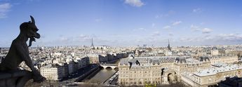
Caption:Notre Dame Gargoyle
© 2007 Duncan McDougall
Description: View taken from Notre Dame Cathedral showing Gargoyle, Seine river, Eiffel Tower and city scape. Taken with Canon Digital Rebel XT and Canon EF 20mm lens. Panorama is composite of 4 individual pictures created with Panorama Factory v3.4
|
|
 |
 |
 |

|
 |
Caption:Le Seine, Paris, France
© 2007 Knut Dalen
|
|
 |
 |
 |

|
 |
Caption:Löwenstein Springtime , Baden-Württemberg , Germany
© 2006 Michael Vogelmann
Title: Löwenstein Springtime , Baden-Württemberg , Germany
|
|
 |
 |
 |

|
 |
Caption:Löwenstein , Baden-Württemberg , Germany
© 2006 Michael Vogelmann
Title: Löwenstein , Baden-Württemberg , Germany
|
|
 |
 |
 |

|
 |
Caption:Landing stage of the rope ferry "Ginsheim".
Landungsplatz der Seilfaehre "Ginsheim".
© 2005 Dieter Seibel
Description: The in-house rope ferry "Johanna" crosses "Ginsheimer Altrhein" and connects the municipality "Ginsheim" with the pure island "Nonnenau" in the landscape protection area of the Hessian Rhine meadows.
Die hauseigene Seilfähre "Johanna" überquert den "Ginsheimer Altrhein" und verbindet die Gemeinde "Ginsheim" mit der Reininsel "Nonnenau" im Landschaftsschutzgebiet der hessischen Rheinauen.
Version of The Panorama Factory = 3.4
Number of photos = 18
Type of camera used = Nikon D2X
Objektiv = Sigma 18-125 mm F 1/3.3-5.6
Focal length = 36 mm (24 real)
Exposure details = f 9 1/320 ISO 160
www.dseibel.de
|
|
 |
 |
 |
|
 |
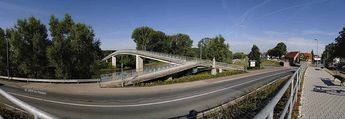
Caption:The Martin Roth Bridge
Die Martin-Roth-Brücke
© 2005 Dieter Seibel
Description: The Martin-Roth-Bridge about the Altrhein connects municipality Erfelden with the nature reserve Kuehkopf-Knoblochsaue. Before the bridge the statue of Johannes von Nepomuk (* around 1350 to 3/20/1393) is to be seen.
Die Martin-Roth-Bruecke über den Altrhein verbindet die Gemeinde Erfelden mit dem Naturschutzgebiet Kuehkopf-Knoblochsaue. Vor der Bruecke ist die Statue von Johannes von Nepomuk (* um 1350 bis 20.03.1393) zu sehen.
Version of The Panorama Factory = 3.4
Number of photos = 13
Type of camera used = Nikon D2X
Objektiv = Sigma 18-125mm F3.3-5.6
Focal length = 27 mm (18 real)
Exposure details = F 10 1/400s ISO 200
www.dseibel.de
|
|
 |
 |
 |

|
 |
Caption:Skyline from Nierstein (left part)
© 2005 Dieter Seibel
Title: Skyline from Nierstein I
Description: Skyline of Nierstein with Rhine kilometer 481.4 with look at the vineyards. In the left partial picture is to be seen "Martinskirche". Well the position the "Oelberg" is to be seen beside the Catholic church (right partial picture). Caused by the big width of the panorama of 3200 pixels this is divided into two same partial pictures of 1600 pixels.
Skyline von Nierstein bei Rhein-Kilometer 481,4 mit Blick auf die Weinberge. Auf dem linken Teilbild ist die Martinskirche zu sehen. Gut zu erkennen ist die Lage "Oelberg" neben der katholischen Kirche (rechtes Teilbild). Bedingt durch die große Breite des Panoramas von 3200 Pixel ist dieses in zwei gleiche Teilbilder von je 1600 Pixel unterteilt.
Version of The Panorama Factory = 3.4
Number of photos = 26
Type of camera used = Nikon D2X
Objektiv = Sigma 80-400mm F4.5-5.6
Focal length = 300 mm (200 real)
Exposure details = F 10 1/400s ISO 200
www.dseibel.de
|
|
 |
 |
 |

|
 |
Caption:Skyline from Nierstein (right part)
© 2005 Dieter Seibel
Title: Skyline from Nierstein II
Description: Description see left part
Version of The Panorama Factory = 3.4
Number of photos = 26
Type of camera used = Nikon D2X
Objektiv = Sigma 80-400mm F4.5-5.6
Focal length = 300 mm (200 real)
Exposure details = F 10 1/400s ISO 200
www.dseibel.de
|
|
 |
 |
 |
|
 |
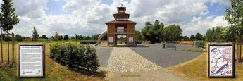
Caption:The fortress Castle Gustavus
Die Festung Gustavusburg
© 2005 Dieter Seibel
Description: During the 30-year-old war the Swedish king Gustav II. Adolf conquered after his victory over the Catholic troops under general Tilly in 1631 the town of Mainz which he wanted to make the capital of new "Protestant Germany" and protect militarily for this target. Hence, in 1632 the Swede's king allowed to establish on the strategically important "Mainspitze" which was at that time still on "Costheimer" district, a gigantic fortress arrangement which was named later after him "castle Gustavus".
Während des dreißigjährigen Krieges eroberte der schwedische König Gustav II. Adolf nach seinem Sieg über die katholischen Truppen unter Feldherr Tilly im Jahre 1631 die Stadt Mainz, die er zur Hauptstadt eines neuen "evangelischen Deutschland" machen und zu diesem Zweck militärisch sichern wollte. Im Jahre 1632 ließ der Schwedenkönig daher auf der strategisch wichtigen "Mainspitze", die sich damals noch auf "Costheimer" Gemarkung befand, eine riesige Festungsanlage errichten, die später nach ihm "Gustavusburg" benannt wurde.
Version of The Panorama Factory = 3.4
Number of photos = 17
Type of camera used = Nikon D2X
Objektiv = Sigma 18-125mm F3.3 - 5.6
Focal length = 27 mm (18 real)
Exposure details = F 14 1/400s ISO 160
www.dseibel.de
|
|
 |
 |
 |
|
 |
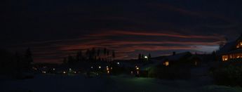
Caption:Winter Night
© 2005 Einar Wedøe
Copyright: © 2005 Einar Wedøe
|
|
 |
 |
 |

|
 |
Caption:City hall with 24 advent calendar windows
Rathaus mit 24 Adventskalender-Fensterbilder
© 2003 Dieter Seibel
Description: Panorama von der Fassade des Ruesselsheimer Rathauses
mit 24 leuchtenden Fensterbilder in seiner ganzen Pracht als Adventskalender.
www.dseibel.de
|
|
 |
 |
 |

|
 |
Caption:Einigen
© 2004 Gruss Herren
Title: Einigen
|
|
 |
 |
 |
|
 |
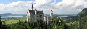
Caption:Castle "Neuschwanstein" in Hohenschwangau, Bavaria, Germany
© 2004 Auer Christian
Title: Castle "Neuschwanstein" in Hohenschwangau, Bavaria, Germany
|
|
 |
 |
 |

|
 |
Caption:die Maria Magdalenen Kapelle im Vordergrund und die dahinter liegende Petrikirche
© 2003 Dieter Wyrembeck
Description: Hallo,
mein Name ist Dieter und ich komme aus Magdeburg in Deutschland.
Neben dem Magdeburger Dom hat die Landeshauptstadt Sachsen Anhalt`s noch einiges Interessantes zu bieten.
Das Panorama zeigt die Maria Magdalenen Kapelle im Vordergrund und die dahinter liegende Petrikirche. Das Bild wurde mit einer Olympus Digitalkamera gemacht im Herbst 2002 gemacht.
Auf meiner Website habe ich noch eine ganze Reihe von Panoramen, Bildern und Grafiken. Vielleicht schaut Ihr ja mal rein "www.webpanorama.2002.ms". Ansonsten ist die Software wirklich gut. Viel Erfolg bei der weiteren Arbeit.
Hello,
my name is Dieter and I come from Magdeburg in Germany. The Panorama shows you the Maria Magdalenen Kapelle and the Petrikirche in the background. The pictures were made with a Olympus Digital-Camera in 2002. On my website a lot of panorama-pictures and photos can be seen.
www.webpanorama.2002.ms
The software that you have created is very good.
Best wishes from
Dieter Wyrembeck
|
|
 |
 |
 |

|
 |
Caption:Le Tréport, Seine Maritime, France
© 2002 Jean-Paul DEFOSSEZ
Title: Le Tréport, Seine Maritime, France
|
|
 |
 |
 |

|
 |
Caption:The castle Pfalzgrafenstein --- Die Burg Pfalzgrafenstein
© 2008 Dieter Seibel
Title: The castle Pfalzgrafenstein --- Die Burg Pfalzgrafenstein
Description: The picture shows the 2-nd military way with the emplacement in the south point. To be able to provide this panorama with 360 degrees as a HDR picture, 16 frames were used with 5 different exposure times in each case.
Das Bild zeigt in der Südspitze den 2. Wehrgang mit dem Geschützstand. Um dieses Panorama mit 360 Grad als HDR-Bild erstellen zu können, wurden 16 Einzelbilder mit jeweils 5 verschiedenen Belichtungszeiten verwendet.
Version of The Panorama Factory = 5.2
Number of photos = 16 x 5
Angular coverage = 360°
Type of camera used = Nikon D3
Objektiv = Nikkor Type G 14-24mm 1/2.8
Focal length = 14 mm (14 real)
Exposure details = f 7.1 (1/8, 1/13, 1/10, 1/6, 1/5) s
ISO 1000
www.dseibel.de
|
|
 |
 |
 |

|
 |
Caption:Info centre of Kuehkopf - Knoblochsaue --- Infozentrum Kuehkopf - Knoblochsaue
© 2007 Dieter Seibel
Description: The exhibits of the info centre give a basic overview about the ecology of the nature reserve. Special attractions show the interactive high water model as well as a physical experience path.
The nature conservation information centre advertises with his exhibits around understanding of the visitors to the thoughtfulness for animals and plants during their tours in the nature reserve.
Die Ausstellungen des Infozentrums geben einen grundsätzlichen Überblick über die Ökologie des Naturschutzgebietes. Besondere Attraktionen stellen das interaktive Hochwasser-Modell sowie ein Naturerlebnispfad dar.
Das Naturschutz-Informationszentrum wirbt mit seinen Ausstellungen um Verständnis der Besucher zur Rücksichtnahme auf Tiere und Pflanzen während ihrer Touren im Naturschutzgebiet.
Version of The Panorama Factory = 5.0
Number of photos = 19
Angular coverage = 270°
Type of camera used = Nikon D2X
Objektiv = Sigma 12-24mm 1/4.5-5.6
Focal length = 12 mm (18 real)
Exposure details = f 10 1/8 s
www.dseibel.de
www.stockstadt.de
|
|
 |
 |
 |

|
 |
Caption:Evangelische Kirche von Dittelsheim-Hessloch in Rheinhessen
© 2007 Dieter Seibel
Title: Evangelische Kirche von Dittelsheim-Hessloch in Rheinhessen
|
|
 |
 |
 |
|
 |
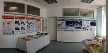
Caption:Climate in the change --- Klima im Wandel
© 2006 Dieter Seibel
Description: An exhibit of the department of Environment and planning of the town Russelsheim on the subject "climate in the change".
Eine Ausstellung vom Fachbereich Umwelt und Planung der Stadt Ruesselsheim zum Thema "Klima im Wandel".
Version of The Panorama Factory = 4.3
Number of photos = 15
Type of camera used = Nikon D2X
Objektiv = Sigma 12-24mm 1/4.5-5.6
Focal length = 18 mm (12 real)
Exposure details = f 8 1/30s ISO 200
www.dseibel.de
www.nabu-rhein-main.de
|
|
 |
 |
 |

|
 |
Caption:Stefanies cellar room
Stefanies Kellerstube
© 2005 Dieter Seibel
Description: Stefanies cellar room is a meeting place for art lovers in Russelsheim-Bauschheim. Here nearly 30 amateur artists from the region issue meanwhile their works and offer this to the purchase.
Stefanies Kellerstube ist ein Treffpunkt für Kunstfreunde in Ruesselsheim-Bauschheim. Hier stellen mittlerweile fast 30 Hobbykünstler aus der Region ihre Arbeiten aus und bieten diese zum Kauf an.
Version of The Panorama Factory = 3.4
Number of photos = 16
Type of camera used = Nikon D2X
Objektiv = Sigma 12-24mm 1/4.5-5.6
Focal length = 18 mm (12 real)
Exposure details = f 4.5 1/25s ISO 500
www.dseibel.de
|
|
 |
 |
 |

|
 |
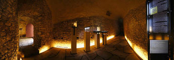
Caption:The well room with next room I.
Die Brunnenstube mit Nebenraum I.
© 2005 Dieter Seibel
Description: This bigger room is connected by a door with the internal fortress ditch and misses at the widest place 6.40 ms, in the length maximum 5.20 ms. Here is a well with a diameter of 1.10 ms which owns an open shaft up to embankment crown. This shaft served to supply living and working soldier with water on the embankment and in the bulwarks.
Dieser größere Raum ist durch eine Tür mit dem inneren Festungsgraben verbunden und mißt an der breitesten Stelle 6,40 m, in der Länge maximal 5,20 m. Hier befindet sich ein Brunnen mit einem Durchmesser von 1,10 m, der einen offenen Schacht bis zur Wallkrone besitzt. Dieser Schacht diente dazu, die auf dem Wall und in den Bollwerken wohnenden und arbeitenden Soldaten mit Wasser zu versorgen.
Version of The Panorama Factory = 3.4
Number of photos = 16
Type of camera used = Nikon D2X
Objektiv = Sigma 14 mm F 2.8
Focal length = 21 mm (14 real)
Exposure details = f 7.1 1s ISO 320
www.dseibel.de
|
|
 |
 |
 |
|
 |
Caption:The well room with next room II.
Die Brunnenstube mit Nebenraum II.
© 2004 Dieter Seibel
Description: This has lain in the internal military ditch of the fortress to Russelsheim below the casemate to the west bastion in a corner between the northwest and southwest embankment. It was cultivated in this gusset directly to the internal retaining wall established before 1507 of the embankment arrangement what an irregular, acute-angled plan originated from.
Diese sind im inneren Wehrgraben der Festung zu Ruesselsheim unterhalb der Kasematte zur Westbastion in einem Winkel zwischen dem nordwestlichen und suedwestlichem Wall gelegen. Sie wurde in diesem Zwickel direkt an die vor dem Jahr 1507 errichtete innere Stuetzmauer der Wallanlage angebaut, wodurch ein unregelmaeßiger, spitzwinkeliger Grundriß entstand.
Version of The Panorama Factory = 3.4
Number of photos = 19
Type of camera used = Nikon D100
Objektiv = Sigma 12-24mm 1/4.5-5.6
Focal length = 19.5 mm (13 real)
Exposure details = f 7.1 1/4s ISO 640
www.dseibel.de
|
|
 |
 |
 |
|
 |
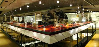
Caption:"Orbis pictus" on the subject Person and Nature
Ein "orbis pictus" zum Thema Mensch und Natur
© 2004 Dieter Seibel
|
|
 |
 |
 |
|
 |
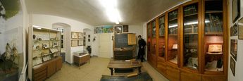
Caption:Schoolroom year 1900
Schulzimmer aus der Zeit um 1900
© 2004 Dieter Seibel
Description: Ein Schulzimmer aus der Zeit um 1900 im Heimatmuseum in Raunheim.
Version of The Panorama Factory = 3.3
Number of photos = 25
Angular coverage = 180°
Type of camera used = Nikon D100
Focal length = 18 mm (12 real)
Exposure details = f 5 1/20 s
www.dseibel.de
|
|
 |
 |
 |

|
 |
Caption:Junkers-52 cockpit
© 2003 Jan Koopstra
Description: Hello John,
First of all, thanks for all the good work which resulted in
version 3.1.
Well, here is another result of my shooting.
This 180 degree pano was taken in a Junkers-52 cockpit during a
historical sightseeing flight above the Netherlands.
It consist of 7 portrait pictures taken with a Minolta X700 / 24 mm
No tripod nor level was used. There was no much time to wait
between shoots (during a flight the background moves, you know.......)
For your information: this Junkers-52 is a German 3-engine plane build
in the 1930's. Only a few are still in service. They are really living
musea and a fun to fly for the crew.
With kind regards,
Jan Koopstra
The Netherlands
|
|
 |
 |
 |
|
 |
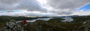
Caption:Hallingskarvet and Strandavatnet as seen from Einsetnuten.
© 2015 Knut Dalen
Title: Hallingskarvet and Strandavatnet as seen from Einsetnuten.
|
|
 |
 |
 |
|
 |
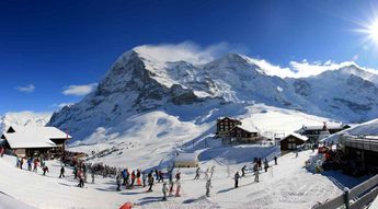
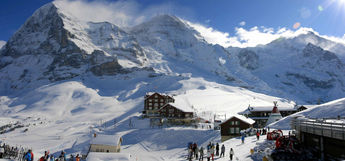
Caption:Eiger and Kleine Scheidegg - version 2
© 2009 Bob Park
Title: Eiger and Kleine Scheidegg - version 2
Description: Eiger and Kleine Scheidegg version2
Panorama V5
Canon 400D
Sigma 17-70 lense
6 photos
|
|
 |
 |
 |
|
 |
Caption:Eiger and Kleine Scheidegg
© 2009 Bob Park
Title: Eiger and Kleine Scheidegg
|
|
 |
 |
 |

|
 |
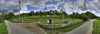
Caption:Autumn in vineyards,Löwenstein
© 2008 Michael Vogelmann
Title: Autumn in vineyards,Löwenstein
|
|
 |
 |
 |
|
 |
Caption:Niersteiner Kanzler-Eck
© 2008 Dieter Seibel
Title: Niersteiner Kanzler-Eck
Description: Inhalt der 3 Schrifttafeln:
Errichtet im Mai 2008 mit Fördermitteln für ehrenamtliche Aktivitäten im Landkreis Mainz-Bingen auf Initiative von Mitgliedern der Alters- und Ehrenabteilung der Freiwilligen Feuerwehr Nierstein.
Dr. Konrad Adenauer Bundeskanzler von 1949 bis 1963 befuhr 1957 bei seinem Besuch diese Strecke.
Das "Valtinche!" - Nebenbahnstrecke Nierstein-Undenheim-Köngernheim. Inbetriebnahme 1. November 1900,
Stillegung Personenverkehr 7. Oktober 1951,
Stillegung Güterverkehr 29. Mai 1960.
Rückbau im Herbst 1960, danach Fuß- und Radweg.
Version of The Panorama Factory = 5.2.2748
Number of photos = 70 (HDR-Picture 14 x 5)
Angular coverage = 180°
Type of camera used = Nikon D3
Objektiv: VR 18-200mm 1/3.5-5.6 G
Focal length = 18 mm (18 real)
Exposure details = f 10 (1/800 1/400 1/200 1/100 1/50 s) ISO 200
www.dseibel.de
|
|
 |
 |
 |

|
 |
Caption:Kjell Haugo and my uncle Jostein (80 years old) at Lordehytta (the Irish lord John Garvagh's cabin from 1860) 1620 meters above sea level, Hallingskarvet National Park, Norway
© 2008 Knut Dalen
Title: Kjell Haugo and my uncle Jostein (80 years old) at Lordehytta (the Irish lord John Garvagh's cabin from 1860) 1620 meters above sea level, Hallingskarvet National Park, Norway
|
|
 |
 |
 |

|
 |
Caption:Niagara Falls
© 2007 Einar Wedøe
Copyright: © 2007 Einar Wedøe
|
|
 |
 |
 |
|
 |
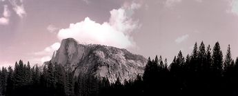
Caption:Half Dome
© 2005 Chris Hunt
Description: This panorama is two images manually stitched using PF v.4.2. The originals were taken on a point and shoot Olympus Stylus loaded with Kodak 35mm (CN) 135 400-iso film. This is B&W Film that is processed locally at the store in house instead of being sent out for processing. I scanned the resulting pictures and took those scans to produce this panorama.
|
|
 |
 |
 |

|
 |
Caption:Alpenwelt
© 2005 Tomislav Cezner
Description: * Alps as seen from Kitzsteinhorn, starting with Steinerer meer(far left)
* Oly C-4000, 7 shots, handheld
|
|
 |
 |
 |

|
 |
Caption:Tamar Bridges, Cornwall and Devon, UK (www.highviewpictures.com)
© 2005 Bernard Harrison
Description: Taken from the stern of a pleasure boat ("Trips round the Harbour"), this shows the rail and road bridges over the Hamoaze (as the estuary of the river Tamar is called). Saltash, Cornwall, is on the left bank. Devonport and Plymouth, Devon, are on the right. The two bridges are seen here almost as one. Brunel could not manage to suspend cables long enough to span the gap - as has the modern, more distant road bridge. His solution was to suspend the cables and chains from three towers. A massive tubular steel pipe was constructed between the towers to stop them from being dragged inwards under the tension of the chains. The main railway line from Penzance to Paddington runs over the bridge.
|
|
 |
 |
 |

|
 |
Caption:The Dome On The Thames
© 2005 John Waterlow
Description: The Millennium Dome on the Greenwich peninsula by the River Thames. Much criticised for being a building without a cause, it will house the gymnastics when London hosts the Olympic Games in 2012.
|
|
 |
 |
 |
|
 |
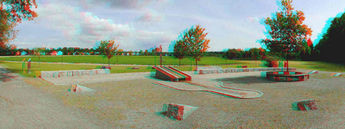
Caption:Virtual three-dimensional view
Virtuelle dreidimensionale Ansicht
© 2005 Dieter Seibel
Description: To be able to see this panoramic picture in a virtual three-dimensional view, red-and-green glasses are necessary moreover. On this occasion, one can see the spatial depth good. One has the best representation with full width of 1600 pixels.
"Sauunter in the Blech". Godfather for the creation of the well arrangement there stood and coat of arms of the municipality of Nauheim. The washing board, the well stone, is hit from a granite block. The water flows into a washbasin.
Um dieses Panorama-Bild in einer virtuellen dreidimensionalen Ansicht sehen zu können, ist hierzu eine Rot-Grüne-Brille erforderlich. Hierbei kann man die räumliche Tiefe gut sehen. Die beste Darstellung hat man bei voller Breite von 1600 Pixel.
"Sauunter im Blech". Pate für die Gestaltung der Brunnenanlage standen Geschichte und Wappen der Gemeinde "Nauheim". Das Waschbrett, der Brunnenstein, ist aus einem Granitblock gehauen. Das Wasser fliesst in ein Becken mit der Kontur eines Wäsche-Bleuels.
Version of The Panorama Factory = 3.4
Number of photos = 17
Type of camera used = Nikon D2X
Objektiv = Sigma 18-125mm F1/3.3-5.6
Focal length = 27 mm (18 real)
Exposure details = f 11 1/500s ISO 250
www.dseibel.de
|
|
 |
 |
 |
|
 |
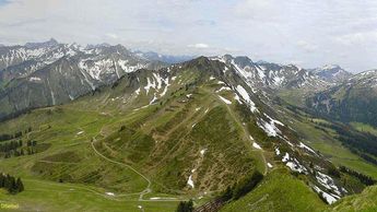
Caption:Kleinwalsertal / Austria
© 2004 Dieter Seibel
Title: Walmendinger Horn im Kleinwalsertal
Description: Glance of the "Walmendinger Horn" in 1993 m of height on the surrounding mountains in the "Kleinwalsertal" / Austria.
Blick vom "Walmendinger Horn" in 1993 m Höhe auf die umliegenden Berge im "Kleinwalsertal" / Österreich.
Version of The Panorama Factory = 3.4
Number of photos = 12
Type of camera used = Nikon D100
Objektiv = Sigma 28-105mm F 1/2.8-4.0
Focal length = 42 mm (28 real)
Exposure details = f 7.1 1/200s ISO 250
www.dseibel.de
|
|
 |
 |
 |
|
 |
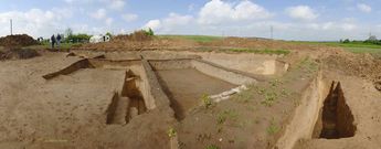
Caption:Grabungen neben der Wickerer Deponie
Einblick in das Alltagsleben der Bronzezeit
© 2005 Dieter Seibel
|
|
 |
 |
 |

|
 |
Caption:grüne wiese
© 2005 armin kurz
Description: einfach eine grüne wiese in der leinemasch im süden von hannover, deutschland.
fuji finepix 2600 zoom
13 bilder
270'
|
|
 |
 |
 |

|
 |
Caption:Lake Mjøsa
© 2005 Einar Wedøe
Copyright: © 2005 Einar Wedøe
|
|
 |
 |
 |
|
 |
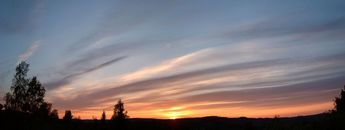
Caption:Sunset
© 2005 Einar Wedøe
Copyright: © 2005 Einar Wedøe
|
|
 |
 |
 |

|
 |
Caption:Totenvika
© 2005 Einar Wedøe
Copyright: © 2005 Einar Wedøe
|
|
 |
 |
 |

|
 |
Caption:Gjøvik
© 2005 Einar Wedøe
Copyright: © 2005 Einar Wedøe
|
|
 |
 |
 |

|
 |
Caption:View of lake Mjøsa
© 2005 Einar Wedøe
Copyright: © 2005 Einar Wedøe
|
|
 |
 |
 |
|
 |
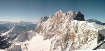
Caption:Dachstein Mountain, Austria
© 2004 Bernhard Spitzer
Title: Dachstein Mountain, Austria
|
|
 |
 |
 |

|
 |
Caption:National preserved area 'Schaeppersee' near Ruesselsheim
Naturschutzgebiet 'Schaeppersee' nahe Ruesselsheim
© 2003 Dieter Seibel
Description: Version of The Panorama Factory = 3.3
Number of photos = 15
Angular coverage = 180°
Type of camera used = Nikon D100
Focal length = 25.5 mm (17 real)
Exposure details = f 8 1/250 s
www.dseibel.de
www.nabu-rhein-main.de
|
|
 |
 |
 |

|
 |
Caption:Exford Wier InfraRed r25
© 2003 Wolfram Steinke
Copyright: © 2003 Wolfram Steinke
|
|
 |
 |
 |

|
 |
Caption:Exford Wier Ektachrome r25
© 2003 Wolfram Steinke
Copyright: © 2003 Wolfram Steinke
|
|
 |
 |
 |

|
 |
Caption:Exford Wier Natural r25
© 2003 Wolfram Steinke
Copyright: © 2003 Wolfram Steinke
|
|
 |
 |
 |

|
 |
Caption:Schweiz, Schaffhausen: Rheinfall
© 2003 Guido Altmann
Title: Schweiz, Schaffhausen: Rheinfall
|
|
 |
 |
 |

|
 |
Caption:Sunset - Table Mountain, Cape Town
© 2004 Harris Steinman
Copyright: © 2004 Harris Steinman
|
|
 |
 |
 |

|
 |
Caption:Mountains of Baosbheinn, Slioch, Bienn Eighe and Liathach in the Scottish highlands
© 2001 Jeremy Thompson, http://www.jeremyjtthompson.co.uk
Title: Mountains of Baosbheinn, Slioch, Bienn Eighe and Liathach in the Scottish highlands
Description: They are taken from Beinn Dearg.
8 pictures covering approximately 180 degrees.
The inital pictures were taken using a Yashica Zoomate 70 without a tripod.
I imagine the focal length to be about 70mm.
They were scanned from prints using a Umax 1220 scanner.
|
|
 |
 |
 |

|
 |
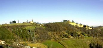
Caption:Near Bologna, Italy
© 2000 Leona Bassein and Edoardo Flescher
Copyright: © 2000 Leona Bassein and Edoardo Flescher
|
|
 |
 |
 |
|
 |
Caption:Near Bologna, Italy
© 2000 Leona Bassein and Edoardo Flescher
Copyright: © 2000 Leona Bassein and Edoardo Flescher
|
|
 |
 |
 |
|
 |
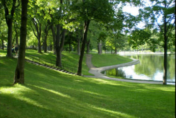
Caption:parc lafontaine Montreal
© 2009 nicole leduc
Description: Parc lafontaine au plein milieu de la ville de montreal.
|
|
 |
 |
 |
|
 |
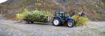
Caption:Svein Kåre's tractor. Hovet, Norway
© 2008 Knut Dalen
Title: Svein Kåre's tractor. Hovet, Norway
|
|
 |
 |
 |
|
 |
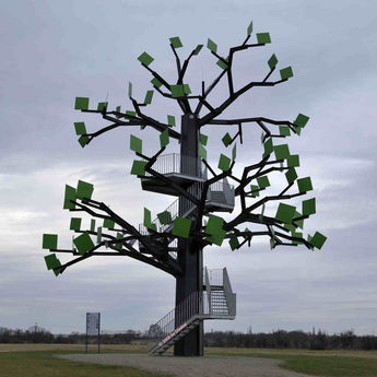
Caption:The Florsheimer steel tree - Der Floersheimer Stahlbaum
© 2008 Dieter Seibel
Description: Daten zur Baumskulptur:
Maße: Hoehe bis zur Kronenspitze 18,00 m, Hoehe der Plattform 9,00 m, Breite der Krone 13,00 m, Stammdurchmesser am Boden 1,20 m. Der Stamm ist mit 24 Schrauben im Fundament eingelassen. Jede Schraube ist 3,5 cm dick und 140 lang.
Material: Stahl in gaengiger Qualitaet.
Aeste: Der Baum hat 10 Aeste. Sie bestehen aus bis zu 29 Einzelabschnitten.
Blaetter: An den Astenden sitzen insgesamt 91 Blaetter. Sie sind 70x70 cm große und 3 mm dicke Stahlbleche. Auf den drei obersten, nach Sueden ausgerichteten Blaettern sitzen Solarzellen. Der erzeugte Strom wird verwendet, um eine Ton- und Klanginstallation zu betreiben. Der Baum spricht und erzeugt Geraeusche.
Fundament: Das Fundament hat die Form eines dreistrahligen Sternes mit einem Kreisdurchmesser von 15,00 m. Die Fundamentriegel sind 1,50m breit und 1,70 m tief. Der Baum ist ein "Flachwurzler".
Version of The Panorama Factory = 5.0
Number of photos = 9
Type of camera used = Nikon D3
AF-S Nikkor 14-24mm f/2.8G ED
Focal length = 24 mm (24 real)
Exposure details = f 8 1/400 s ISO 500
www.dseibel.de
|
|
 |
 |
 |

|
 |
Caption:Landing stage with Rope Rider ... Landungsplatz mit Leinreiter
© 2007 Dieter Seibel
KEYWORDS: Leinreiter
Title: Landing stage with Rope Rider ... Landungsplatz mit Leinreiter
Description: Rope rider. Before the operation of the steam machine in the ship journey the ships were drawn upstream by horses in the rope. In memory of the centuries of rope rider at the Main and their importance for Russelsheim the town let in 1994 put up the statue. See also picture moreover
www.panoramafactory.net
Leinreiter (mundartlich auch Leinereiter). Vor dem Einsatz der Dampfmaschine in der Schifffahrt wurden die Schiffe stromaufwaerts von Pferden an der Leine gezogen. Zur Erinnerung an die jahrhundertelange Leinreiterei am Main und ihre Bedeutung fuer Ruesselsheim liess die Stadt 1994 das Standbild aufstellen. Siehe hierzu auch Bild unter
www.panoramafactory.net
Version of The Panorama Factory = 5.0
Number of photos = 24
Type of camera used = Nikon D3
Objective = Sigma 12-24mm F 4.5-5.6 DG HSM
Focal length = 24 mm
Exposure details = f 6.3 1/30s ISO 1600
www.dseibel.de
|
|
 |
 |
 |

|
 |
Caption:Kanal-Kreuzung bei Geinsheim
© 2007 Dieter Seibel
KEYWORDS: Geinsheim
Title: Kanal-Kreuzung bei Geinsheim
|
|
 |
 |
 |

|
 |
Caption:Kanal-Kreuzung bei Geinsheim
© 2007 Dieter Seibel
KEYWORDS: Geinsheim
Title: Kanal-Kreuzung bei Geinsheim
|
|
 |
 |
 |

|
 |
Caption:Rope Rider ... Leinreiter
© 2005 Dieter Seibel
Title: Rope Rider ... Leinreiter
Description: Rope rider. Before the operation of the steam machine in the ship journey the ships were drawn upstream by horses in the rope. In memory of the centuries of rope rider at the Main and their importance for Russelsheim the town let in 1994 put up the statue.
Leinreiter (mundartlich auch Leinereiter). Vor dem Einsatz der Dampfmaschine in der Schifffahrt wurden die Schiffe stromaufwaerts von Pferden an der Leine gezogen. Zur Erinnerung an die jahrhundertelange Leinreiterei am Main und ihre Bedeutung fuer Ruesselsheim liess die Stadt 1994 das Standbild aufstellen.
Version of The Panorama Factory = 4.0
Number of photos = 18
Type of camera used = Nikon D2X
Objective = Sigma 18-125mm F 3.3-5.6
Focal length = 27 mm (18 real)
Exposure details = f 9.0 1/250s ISO 250
www.dseibel.de
|
|
 |
 |
 |
|
 |
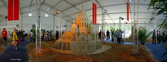
Caption:Special show sand World
Sonderschau Sand World
© 2005 Dieter Seibel
Description: A highlight of this year's Hessen show in Darmstadt is based at the biggest sand sculptures party of Europe that since 2002 is organized yearly in Travemünde and since inspires thousands of people. For this event 115 metric tons of special sand were unloaded by the 'Maas' on the 'Messplatz'. On a surface of 1,000 square meters performers conjure from it simulations of famous buildings and sculptures.
Ein Highlight der diesjährigen Hessenschau in Darmstadt basiert auf Europas größtem Sandskulpturenfest, daß seit 2002 jährlich in Travemünde veranstaltet wird und seitdem Tausende von Menschen begeistert. Für dieses Event wurden 115 Tonnen Spezialsand von der Maas auf dem Messplatz abgeladen. Auf einer Fläche von 1000 Quadratmetern zaubern Künstler daraus Nachbildungen berühmter Bauwerke und Skulpturen.
Version of The Panorama Factory = 3.4
Number of photos = 10
Type of camera used = Nikon D2X
Objektiv = Sigma 18-125mm F 3.3-5.6
Focal length = 27 mm (18 real)
Exposure details = f 4.0 1/60s ISO 3200
www.dseibel.de
|
|
 |
 |
 |

|
 |
Caption:Water stones ground: Water
Wassersteine Grund: Wasser
© 2005 Dieter Seibel
Title: Water stones ground: Water --- Wassersteine Grund: Wasser
Description: Stones point to the ground water in the "Ried" --- Resulted in summer, 1997 in a sculptor's workshop of the adult education program in the "Ried". The "water stones on the Wasen " symbolize the ground water stock of the reeds scenery. They refer to a great ground water memory which supplies the surrounding municipalities, but also great parts of the Rhine Main region with drinking water.
Steine weisen zum Grundwasser im "Ried" --- Entstanden im Sommer 1997 in einer Bildhauerwerkstatt der Volkshochschule im Ried. Die "Wassersteine auf dem Wasen" symbolisieren den Grundwasservorrat der Riedlandschaft. Sie verweisen auf einen großen Grundwasserspeicher, der die umliegenden Gemeinden, aber auch große Teile der Rhein-Main-Region mit Trinkwasser versorgt.
Version of The Panorama Factory = 3.4
Number of photos = 15
Type of camera used = Nikon D2X
Objektiv = Sigma 18-125mm F 3.3-5.6
Focal length = 67.5 mm (45 real)
Exposure details = f 9 1/320s ISO 200
www.dseibel.de
|
|
 |
 |
 |

|
 |
Caption:Solar clock in the Russelsheim "Horlachegraben"
Sonnenuhr am Ruesselsheimer Horlachegraben.
© 2005 Dieter Seibel
Description: The sun gives us spatial orientation. Already the statement that the sun rises in the morning in the east and declines in the evening in the west gives us a rough orientation after directions. From the exact determination of the solar trinkets one can determine with knowledge of the time and the date the precise position. Solar clocks give always the local time of the concerning place. Because the Central European time (CET) is the local time on the line "Stargard-Gorlitz", the Russelsheim local time indicated on the solar clock follows about 26.4 minutes.
Die Sonne gibt uns raeumliche Orientierung. Bereits die Feststellung, dass die Sonne morgens im Osten aufgeht und abends im Westen untergeht, gibt uns eine grobe Orientierung nach Himmelsrichtungen. Aus der exakten Bestimmung des Sonnenstands kann man bei Kenntnis der Uhrzeit und des Datums die genaue Position bestimmen. Sonnenuhren geben immer die Ortszeit des betreffenden Ortes an. Da die Mitteleuropaeische Zeit (MEZ) die Ortszeit auf der Linie Stargard-Goerlitz ist, geht die auf der Sonnenuhr angezeigte Ruesselsheimer Ortszeit um 26,4 Minuten nach.
Version of The Panorama Factory = 3.4
Number of photos = 19
Type of camera used = Nikon D2X
Objektiv = Sigma 12-24mm F 4.5-5.6
Focal length = 24 mm (16 real)
Exposure details = f 9 1/250s ISO 250
www.dseibel.de
|
|
 |
 |
 |
|
 |
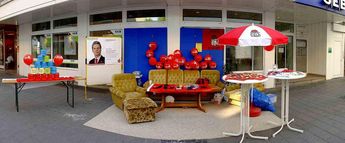
Caption:Ein Ruesselsheimer fuer unsere Stadt mit 64,5 % hat er die OB-Wahl gewonnen.
© 2005 Dieter Seibel
Title: Ein Ruesselsheimer fuer unsere Stadt
|
|
 |
 |
 |
|
 |
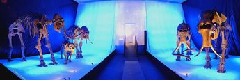
Caption:Exposition of mammoth to Erbach
Mammut-Ausstellung im Erbacher Elfenbeinmuseum
© 2005 Dieter Seibel
|
|
 |
 |
 |
|
 |
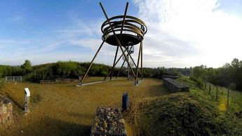
Caption:Bird's nest near Hochheim
Aussichtskanzel "Vogelnest" nähe Hochheim / Main
© 2004 Dieter Seibel
Description: The bird's nest was distinguished with the Johann-Wilhelm-Lehr-Plakette in 2003, award by the alliance of German architects. This alliance distinguished within the scope of the German timber-frame construction price in 2003 the bird's nest with a laudatory mention.
Das Vogelnest wurde ausgezeichnet mit der Johann-Wilhelm-Lehr-Plakette 2003, vergeben durch den Bund Deutscher Architekten. Dieser Bund zeichnete im Rahmen des Deutschen Holzbaupreises 2003 das Vogelnest mit einer lobenden Erwaehnung aus.
Version of The Panorama Factory = 3.3
Number of photos = 11
Angular coverage = 180°
Type of camera used = Nikon D100
Focal length = 18 mm (12 real)
Objektiv Sigma 12-24 mm F4.5-5.6
Exposure details = f 9 1/320 s ISO 250
www.dseibel.de
|
|
 |
 |
 |
|
 |
Caption:The Raven / Der Rabe
© 2004 Dieter Seibel
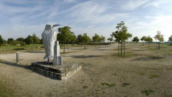
Description: The raven created by the Floersheimer artist Thomas Reinelt was put up in 1998 as the first object of the regional park program "art in the scenery" in the walnut-tree accommodation. The nearly 3 m high aluminum sculpture stands as a terminator point in the axis of the avenue Speierling. The raven counts equally as an allegory to nature and sociability.
Der von dem Floersheimer Kuenstler Thomas Reinelt geschaffene Rabe wurde 1998 als erstes Objekt des Regionalparkprogramms "Kunst in der Landschaft" im Nussbaumquartier aufgestellt. Die fast 3 m hohe Aluminium-Skulptur steht als Endpunkt in der Achse der Speierlingallee. Der Rabe gilt gleichermaßen als Sinnbild fuer Natur und Geselligkeit.
Version of The Panorama Factory = 3.3
Number of photos = 22
Angular coverage = 180°
Type of camera used = Nikon D100
Objektiv = Sigma 12-24 mm/F4.5-5.6
Focal length = 30 mm (20 real)
Exposure details = f 10 1/320 s ISO 250
www.dseibel.de
|
|
 |
 |
 |
|
 |
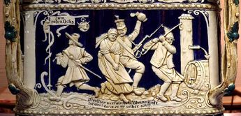
Caption:Rotenochs
© 2003 Jody Wyse
Description: Hi.
I recently purchased a digital camera and a friend loaned me an old copy
(v1.?) of Panorama Factory to try. I collect antique beer steins and had an
idea to reverse the panorama process and take a shot of the scene on a stein
that wraps around the stein. This file attached is a first try (and very
scaled down bit-wise).
With this method, I can share the entire scene on a stein with fellow
collectors without missing anything. I took 8 shots with a Sony DSC-P9.
Clipped them to just contain the center portion of the photo, then stitched
the sections together. Guess it's about 330 degrees.
Please let me know what you think. I am also planning to write an article
for a beer stein collectors magazine (www.steincollectors.org). The article
will be about the stein, but I will probably include a 2nd article
about "Panoram Factory."
Sure seems like a terrific program. I still have much to learn about it, and
am now downloading v3.0 to give another try.
Thanks.
-Jody Wyse
|
|
 |
 |
 |
|
 |
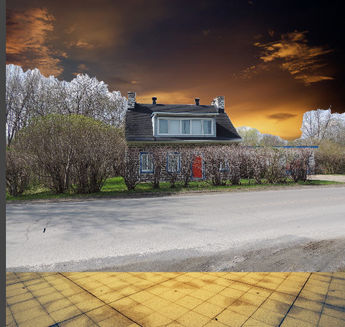
Caption:Maison Atelier du peintreAlfred Pellan.
© 2014 nicole leduc
Title: Maison Atelier du peintreAlfred Pellan.
|
|
 |
 |
 |

|
 |
Caption:Charlotte and Ole Marius climbing the lighthouse, Kaptein Sabelstann's World, Dyreparken, Kristiansand, Norway
© 2008 Knut Dalen
Title: Charlotte and Ole Marius climbing the lighthouse, Kaptein Sabelstann's World, Dyreparken, Kristiansand, Norway
|
|
 |
 |
 |

|
 |
Caption:Nina at the mountain Bølhovd, the mountain Reineskarvet in the background, Norway.
© 2008 Knut Dalen
Title: Nina at the mountain Bølhovd, the mountain Reineskarvet in the background, Norway.
|
|
 |
 |
 |
|
 |
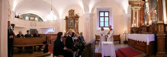
Caption:Kirche
© 2006 Johannes Weinzerl
Copyright: © 2006 Johannes Weinzerl
|
|
 |
 |
 |

|
 |
Caption:Standesamt
© 2006 Johannes Weinzerl
Copyright: © 2006 Johannes Weinzerl
|
|
 |
 |
 |
|
 |
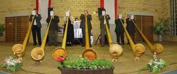
Caption:Ockenheimer Alphornblaeser
© 2002 Dieter Seibel
Description: Das Panorama wurde in der Dalheimer Gemeindehalle bestehend aus drei Einzelbilder zusammengesetzt.
www.dseibel.de
|
|
 |
 |
 |
|
 |
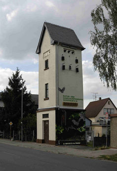
Caption:Hochformat-Panorama vom Fledermaushaus in Geinsheim
© 2007 Dieter Seibel
KEYWORDS: Geinsheim
Title: Hochformat-Panorama vom Fledermaushaus in Geinsheim
Description: Version of The Panorama Factory = 4.5
Number of photos = 9
Type of camera used = Nikon D2X
Objektiv = AF-S NIKKOR 18-200mm F3.5-5.6
Focal length = 54 mm (36 real)
Exposure details = F 9 1/320s ISO 250
www.dseibel.de
www.nabu-rhein-main.de
|
|
 |
 |
 |
|
 |
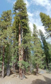
Caption:Redwood at Yosemite
© 2005 Chris Hunt
Description: This is four pictures with a Sony DSC-P10 taken in the fall of 2005 and panoramed using PF v.4.2. This tree was on the side of the road and wasn't all that spectacular for Yosemite but for a life long east coaster, it was pretty huge. The base is shot head on. I shot the upper reaches leaning backwards giving the other trees close by their leaning appearance. It wasn't until I got home, 3000 miles across country and a week later, that I realized I didn't get the upper reaches of the crown when I took the pictures. Oh well.
I have since taken this image and put it into movie maker with a slight wind soundtrack. It takes forty seconds to go from the base to the crown and is perhaps even more striking than seeing the basic image. There is a lot that can be done with these images!
|
|
 |
 |
 |
|
 |
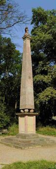
Caption:The Sweden Colums
Die Schwedensaeule
© 2005 Dieter Seibel
Description: The Sweden column reminds of the legendary Rhine crossing of the Swede's king Gustav II. Adolf (1594 - 1632) which overcame on the 7th December 1631 with his army at this point the Rhine and hit on the other Rhine side the Spaniards in the escape. This was established 1632 before the death of the king still on his behest at this point. The lion sitting enthroned on the column looks in the direction, in that the crossing occurred after that landing place, the battlefield and Swede's churchyard.
Die Schwedensaeule erinnert an den legendaeren Rheinuebergang des Schwedenkoenigs Gustav II. Adolf (1594 - 1632), der am 7. Dezember 1631 mit seinem Heer an dieser Stelle den Rhein ueberwand und auf der anderen Rheinseite die Spanier in die Flucht schlug. Diese wurde 1632 vor dem Tode des Koenigs noch auf dessen Geheiss an dieser Stelle errichtet. Der auf der Saeule thronende Loewe schaut in die Richtung, in der die Ueberfahrt erfolgte nach jener Landungsstelle, dem Kampfplatz und Schwedenkirchhof.
Version of The Panorama Factory = 3.4
Number of photos = 12
Type of camera used = Nikon D2X
Objektiv = Sigma 18-125 mm F 1/3.3-5.6
Focal length = 51 mm (34 real)
Exposure details = f 10 1/500 ISO 250
www.dseibel.de
|
|
 |
 |
 |
|
 |
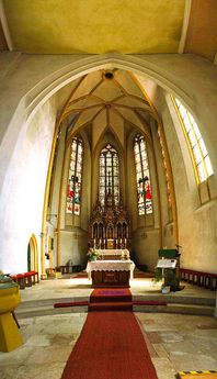
Caption:Chancel ot the catholic parish church to Undenheim
Altarraum der katholische Pfarrkirche zu Undenheim
© 2005 Dieter Seibel
Description: Chancel from the Catholic parish church the Assumption Day to Undenheim in Rheinhessen.
Altarraum von der katholischen Pfarrkirche Mariä Himmelfahrt zu Undenheim in Rheinhessen.
Version of The Panorama Factory = 3.4
Number of photos = 11
Type of camera used = Nikon D2X
Objektiv = Sigma 18-125 mm F 1/3.3-5.6
Focal length = 27 mm (18 real)
Exposure details = f 3.5 1/50 ISO 500
www.dseibel.de
|
|
 |
 |
 |
|
 |
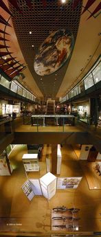
Caption:Three floors of the Russelsheim museum
Drei Etagen vom Ruesselsheimer Museum
© 2005 Dieter Seibel
Description: Three upper floors of the Russelsheim museum show the exhibits:
Prehistory up to Roman time --- Russelsheim of the Middle Ages up to the beginning of the industrialization --- Russelsheim from the beginning of the industrialization till 1945 --- Person and nature with "orbis pictus naturae", an ecological overview of the prehistory up to industrial time.
Die drei oberen Etagen vom Ruesselsheimer Museum zeigen die Ausstellungen:
Urgeschichte bis zur Roemerzeit --- Ruesselsheim vom Mittelalter bis zum Beginn der Industrialisierung --- Ruesselsheim vom Beginn der Industrialisierung bis 1945 --- Mensch und Natur mit "orbis pictus naturae", ein oekologischer Ueberblick von der Urgeschichte bis zur Industriezeit.
Version of The Panorama Factory = 3.4
Number of photos = 18
Type of camera used = Nikon D2X
Objektiv = Sigma 14 mm F 1/2.8
Focal length = 21 mm (14 real)
Exposure details = f 8 1/2.5 ISO 400
www.dseibel.de
|
|
 |
 |
 |
|
 |
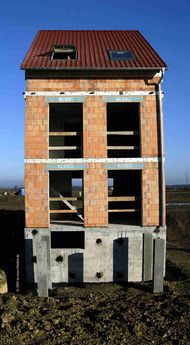
Caption:Rough brickwork
Rohbau von einem Reihenhaus
© 2005 Dieter Seibel
Title: Rough brickwork --- Rohbau von einem Reihenhaus
|
|